Adina Sommers will be joining the London Map Fair on June 7th and 8th 2014 to participate in the largest antique map fair in Europe. The Antique Map Fair started in 1980 to create an environment where novice collectors, curators, experts and other enthusiasts can find original maps and exchange knowledge. Adina Sommers exhibit will have a special collection of antique historic maps that any collector would appreciate. Here is a sneak peak of some of the antique maps that will be exhibited.

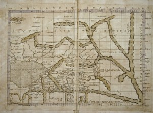
“Tabula Septima De Asia”
This map is very rare. The map shows the Caspian Sea with Kazakhstan, Uzbekistan and Hindu Kush. The rivers and mountains are roughly shown in the country on the side the climatically zones.
Special Features: Ptolomey watermark on the right side. The map has gold dust ennobled mountains, printed on two sheets.
Dimensions: (33 x 47,50 cm)
Interesting Facts about Francesco Berlinghieri
Berlinghieri’s edition of Ptolemy is unique. He was one of the first to print a text based on Ptolemy’s Geographica. His edition of Ptolemy includes 31 maps covering Europe, northern Africa and the south part of Asia and is the first atlas to attempt the introduction of modern geography, with the inclusion of four new maps – France, Italy, Spain and Palestine based on contemporary knowledge rather than a strict plotting of Ptolemy’s coordinates.

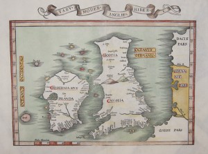
“Tabu Moder Anglie u. Hiber”
This antique map shows a total of Great Britain. The map was first issued in 1522 and is a redrawing and reduction of the 1513 Ptolemaic map of the British Isles. A final issue of the map was published in 1541.
Special Features: The title appears in a scroll above the top border.
Dimensions: ( 31,5 x 40,5 cm )
Interesting Facts about Laurent Fries
In 1520 Fries started mapmaking by executing a reduction of Martin Waldseemuller’s 1507 wall-map of the World. Fries execution was a new edition of the Geographia of Claudius Ptolemy, which was published by Johann Koberger in 1522. Fries originally intended for his maps to be part of a new Chronica Mundi being written by Martin Waldseemüller. Waldseemüller died before the completion of the work. Fries then used his woodcut maps to publish a smaller sized edition of Waldseemüller’s Geographia.

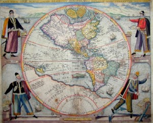
This is an antique map of America in a Hemisphere. The map shows an explorer, namely Columbus, Vespuci, Magellan and Picard in each corner.
Dimensions: (33 x 39cm )
Interesting Facts about Theodor De. Bry
Bry and his son John-Theodore adjusted both the texts and the illustrations of Le Moyne’s paintings. In Bry’s illustrations, Amerindians look like Mediterranean Europeans and there was a mix of different tribal customs and artifacts. In addition to day-to-day life of the American natives, Theodor de Bry even included a few depictions of cannibalism. The vast amount of these illustrations and texts influenced the European perception of the New World, Africa, and Asia.
Date: Saturday 7th June 2014; 12.00 pm to 7.00 pm
Sunday 8th June 2014; 10.00 am to 6.00 pm
Location:Royal Geographical Society
1 Kensington Gore
London SW7 (Entrance Exhibition Road)


