Adina Sommer recently featured Phillip Clarke for his exceptional work on exploring the contributions of Mercator to the use of the term Australia. The blog post explored the use of the term “Australia” and found that a decade ago it was discovered that the term “Australia” was printed as early as 1545 as it was found on a small figure of the world in the book Astronomia-Teutsch Astronomei.
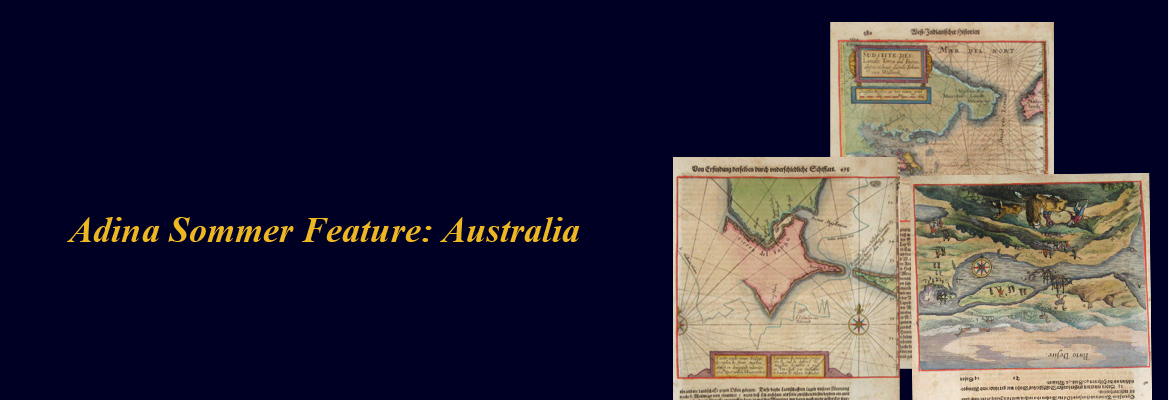
Adina Sommer wants to continue looking at “Australia” by featuring some of the maps in the collection. The post features popular maps by Theodorus de Bry, who was an engraver, goldsmith and editor who took several journeys around Europe. Theodor de Bry wrote about his observations and created very detailed illustrations based on his travels. Tierra Del Fuego, an archipelago in the South American mainland is featured in some of the maps.Tierra Del Fuego was popular for its mountains, Charles Darwin had this to say about it:
“December 20th, 1832. [...] When we reached the hill we found it the highest in the immediate neighbourhood, and the waters flowed to the sea in opposite directions. We obtained a wide view over the surrounding country: to the north a swampy moorland extended, but to the south we had a scene of savage magnificence, well becoming Tierra del Fuego. There was a degree of mysterious grandeur in mountain behind mountain, with the deep intervening valleys, all covered by one thick, dusky mass of forest. The atmosphere, likewise, in this climate, where gale succeeds gale, with rain, hail, and sleet, seems blacker than anywhere else. In the Strait of Magellan looking due southward from Port Famine, the distant channels between the mountains appeared from their gloominess to lead beyond the confines of this world.” (http://www.tierradelfuego.org.ar)

Theodor De Bry (1960) Sudseite des Landts Terza del Fuoco, abgezeichnet durch Iohan von Waldeck.
This map shows Cap Horn and the Terra del Fuego

This map shows Porto, Patagoniea


This map shows Tierra del Fuego